Page 1 of 1
Donjebruche Campaign Area Map
Posted: Sun Aug 19, 2012 8:32 pm
by Jeffr0
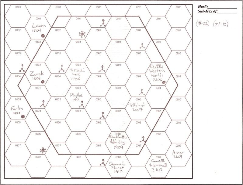
The blank hex numbered 0604 is where the party is currently headed-- it is a rare 3-way neutral zone. (The numbers I wrote in are the correct F&E reference coordinates.)
Star bases and battle stations are marked... as are major economic world hexes.
Each hex on this map will contain 1000+ stars, 100+ planets, and (at least) a few colonies or worlds that are home to sentient life.
[The nature of Blackfoot Pass is relevant to understanding the terrain of SFU.]
Posted: Wed Aug 22, 2012 8:19 pm
by Jeffr0
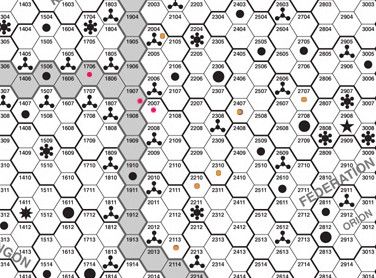
Some interdicted worlds of the Federation that Muankaal thinks could have relevant Old Kings archaeological sites:
World: Tarsus II
Hex: 2210
Signature Terrain: River
World: Forlorn III
Hex: 2310
Signature Terrain: Clear
World: Karnak II
Hex: 2707
Signature Terrain: Forest
World: Mu VII
Hex: 2004
Signature Terrain: Mountain
World: Anacreon V
Hex: 2407
Signature Terrain: Ocean Depths
World: Moebius IV
Hex: 2113
Signature Terrain: Chasm
Posted: Wed Aug 22, 2012 9:13 pm
by Jeffr0
In red: Mad Jack's Hole in 1706, Smuggler's base in 1907, and Taffeland in 2007.
Also... the interdicted worlds are marked in yellow.
Posted: Thu Aug 23, 2012 3:23 pm
by Jeffr0
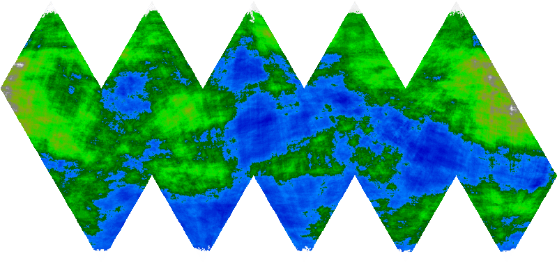
Mu VII: Not much is known due to the restricted nature of the information. The Federation claims to have interdicted the world in order to protect the unique civilization of the Vasi V'Sooma. The planet's most striking feature is the gigantic plateau that takes up most of the main continent.
Class H: This is an "early Earth" planet with a developing biosphere (mostly bacteria, some low-grade plants). The atmosphere will be unbreathable to humans.
Size: 6 (Diameter 6,000 miles)
Atmosphere: 4 (Thin tainted atmosphere, requres the use of filter masks.)
Hydrographics: 4 (40% Water)